Sunday, July 4, 2021

You'll Be Back! Happy Independence Day!

King George III (from the musical Hamilton)


You'll be back, soon you'll see
You'll remember you belong to me
You'll be back, time will tell
You'll remember that I served you well
Oceans rise, empires fall
We have seen each other through it all
And when push comes to shove
I will send a fully armed battalion to remind you of my love!


Well, one thing that was back was a traditional Fourth of July celebration day this year in 2021. We went to the local Lake Bluff Fourth of July Parade this morning and I have to say that it felt good to be out in the sunshine, frying due to a lack of sun screen, and watching Ameicana right before my eyes. To wit, kids running around water balloons, families and friends gathering for a picnic along the parade route, adults drinking way too many beers at 9:30 A.M, uh, never mind about the latter.
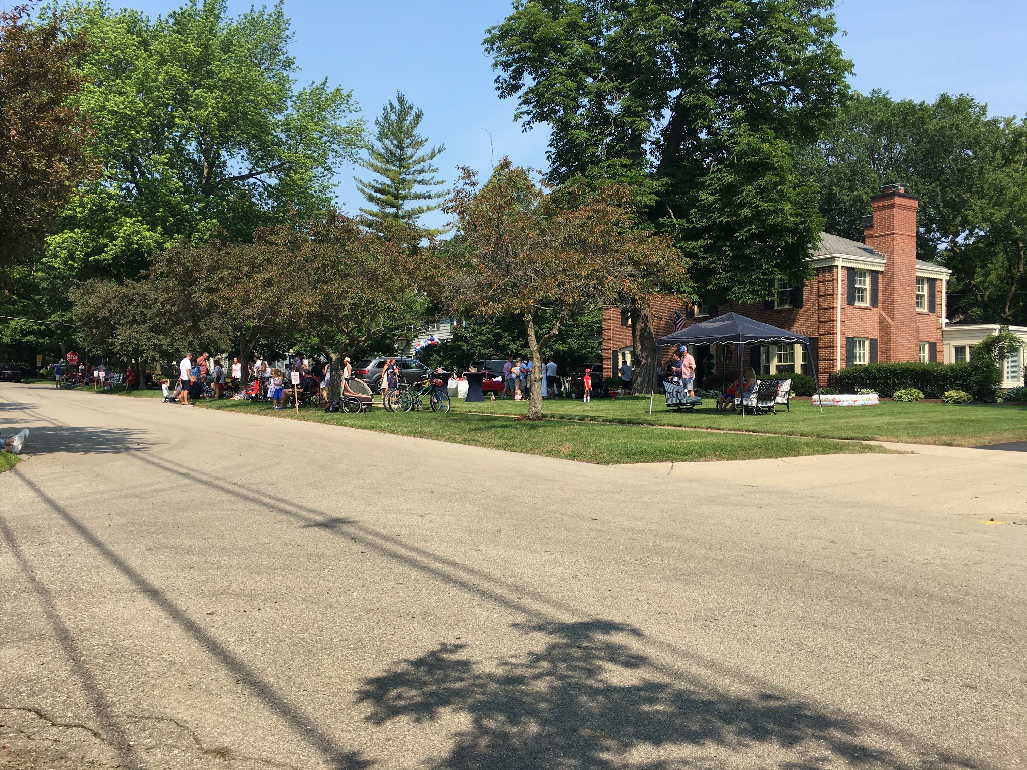
People set up tent flies, tables, chairs and food in front of their homes and invited their friends and neighbors over to party.


This year's parade was smaller than normal due to Covid-related restrictions and social distancing, I guess. Marching bands were eliminated as were any groups that had to walk rather than ride on a parade float or trailer. There were several small bands that had their equipment set up on flat bed trailers as they rolled along the parade route. There was even a truncated Highland Pipe Band that had a few pipers and drummers riding in the back of a pickup truck - how's that for an image.

Here are a couple of the bands:


This steel band group towed by an old 1960s hippie bus particularly caught my eye.


There were several "floats" that featured Darth Vader or Bobba Fett for some reason. Apparently The Force played a role in our independence from Britain.


The parade always has an assortment of old cars showing off.


The Civil War re-enactors usually lead off the parade, carrying the old Stars and Stripes, and firing a musket volley. Not this year though. Friendly chaps, none the less.


This Civil War re-enactment group looks a little long in the tooth, but they remembered that today was the day that Vicksburg surrendered to General Grant.

This year the Shriners rode on Segways instead of the rickety little mini-cars.
This rider seems to be happy about the change in his ride.


Lelia wanted to go to the parade primarily to watch and hear the pipe bands. We did not expect to see them due to the "no walking" rule so it was a nice suprise to see The Midlothian Bank playing some tunes to the scirl of the pipes.


Alas, they were taking a music rest as they passed our position and then, naturally, started playing again as their truck rolled out of sight.

The parade always ends with an endless stream of loud, obnoxious fire trucks belching their horns.


It all seemed to work though even with all of the changes made for this year's parade. What made it all work was watching families and friends gathering together along the parade route and just having fun on a sunny Fourth of July day.

After the parade, we headed home and got the house ready for a barbecue party with friends that we have not seen in person for over a year. That was the best part of the day for me. I did the grilling of the burgers and brats (it was hot outside!) on the Weber grill outside while our guests stayed in the comfort of the air conditioned house. I received lots of compliments for my grilling skills, which I must admit, are decidedly average. However, on a day like this, one's effort is greatly appreciated.

Later tonight we will walk a few blocks down the street and take up our perch from which to watch the town's fireworks display.

I think that Americans needed a somewhat normal Fourth of July with parades, parties with friends and fireworks. Maybe I'm a bit maudlin about the day, but July Fourth serves to remind Americans that we have a lot more in common than we do our differences.


Saturday, July 3, 2021

Fredericksburg! Fredericksburg!


The Sargeant Kirkland monument on Marye's Heights at Fredericksburg.

The day after our visit to Washington Diet Coke (you see what I did there?) we travelled south to Fredericksburg, Virginia to see four Civil War battlefields in one day. Within a few short miles of each other, one can visit Fredericksburg (1862), Chancellorsville (1863), The Wilderness (1864) and Spotsylvania Court House (1864).

We left our base in Warrenton, Virginia and headed south on US17 to Fredericksburg, following my paper Rand Macnally map. I'd had enough of Siri sending me in the wrong direction time after time.

Our first stop in the town was at the Visitors' Center where we were able to get the lay of the land and directions for how to get to Marye's Heights. I knew the general direction of the ground but I was having a rough go of finding the correct road that leads to the battlefield visitors' center. Once there, we joined a park ranger tour of the Sunken Road area and snapped some of the pictures shown below.

The Sunken Road and stone wall which was occupied by the Confederates

This was the approach to the Sunken Road on Maryes Heights. In the mid distance you can barely make out a swale (depression) in the ground where advancing Union soldiers were pinned down by Confederate fire. Obviously none of these buildings were present at the time of the battle.

National Park Service ranger giving a tour of the battle at the Sunken Road.


One of the houses remaining from the fighting in the Sunken Road. 
Confederate general Cobb was mortally wounded from a piece of
artillery shrapnel while standing inside this house.

Lelia is taking a close up photo of the bullet holes that are still visible in the house.

While the Union assault on Marye's Heights gets all of the publicity about the battle, the battle of Fredericksburg was won or lost further to the south (right flank of the Confederate line held by Stonewall Jackson) on the high ground around Prospect Hill. 

Interpretive plaque illustrating the attack of Meade's division and its potential break through of the Confederate  line  commanded by Stonewall Jackson.


Some of the Conferate trenches in Jackson's line.


Another interpretive plaque showing the position of Confederate siege artillery at Howison Hill, part of  the Confederate right flank.


Representation of the Confederate battery on Howison Hill. A 30-pound Parrot on the left and a 12-pound howitzer on the right.


Confederate 30-pound Parrot siege cannon. Yikes! This gun is huge.


After viewing the area of Jackson's corps on the heights on the right flank, we ventured down to the open plain below, called the Slaughter Pen Farm area of the battle. Major General Meade's division attacked across this open ground towards Jackson's lines. There was a clump of woods sticking out like a salient, full of muck and mire, such that Jackson did not think that any troops could advance through such terrain. So he had the area lightly defended. Of course, this is precisely the point where Meade's attack broke through the Confederate line. However, Meade was not reinforced by the rest of the corps and so he was not able to solidify his lodgement in the Confederate line. The Confederate counter-attack eventually forced Meade to withdraw back to his starting point.


The Slaughter Pen Farm is a wide open tract of farmland that was preserved by the American Battlefield Trust (formerly called the Civil War Trust). Historian Ed Bearss called 208-acre Slaughter Pen Farm "one of the most significant tracts of land in the war". The ABT was able to raise the $12 million dollars needed to purchase the land and save it from developers, who wanted to build a light industrial park on the land. As you drive south from Fredericksburg on US1 towards Richmond, VA you pass vast tracts of land lost forever to light industrial buildings, schools, residential housing and other buildings. This is what would have happened to the Slaughter Pen Farm had the ABT not stepped in to purchase the land.


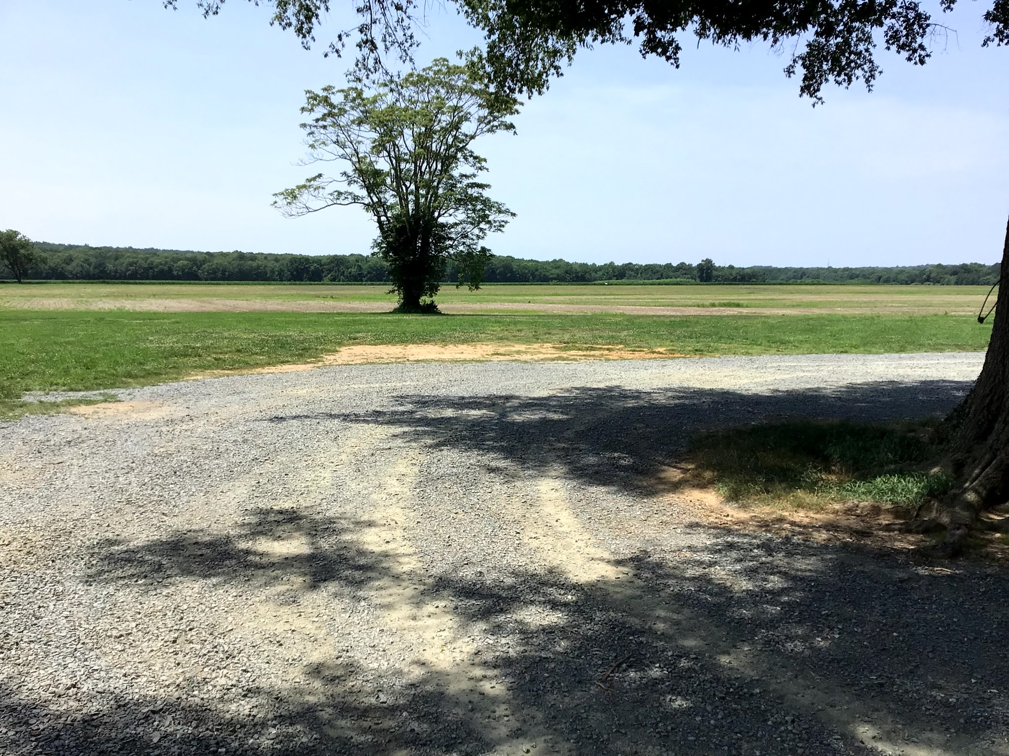
The first three pictures, below, provide a panorama of the battlefield, starting from left to right. The wooded area in the background is where the high ground was located - occupied by Jackson's Confederates.

Left view

Center view


Right hand view


The remains of the actual "Slaughter Pen" farm. Modern day barns and silos were razed so that the battlefield would look as it did in December 1862.


The Civil War Trust, Central Virginia Battlefield Trust, and other preservation groups erected plaques that list the names of all of the donors who collectively came up with the necessary funds to purchase the land.


I was one of the donors for this piece, and others, of land saved by the ABT. 


I encourage any of my readers with an interest in the American Civil War and historical land preservation efforts to click on the following link: American Battlefield Trust and just peruse through the web site to see what the organization has done to preserve land and to view current fund raising efforts. You don't have to donate any money, but if you are so inclined, then any amount, small or large is helpful. Even a $5 or $10 donation helps the ABT. Think of it as foregoing one cup of coffee from Starbucks for a week.


Map of the fighting on the Confederate right flank at the Slaughter Pen Farm.
Civil War Preservation Trust map.


NEXT POST: Chancellorsville, Wilderness and Spotsylvanis C.H.

Monday, June 28, 2021

Shuffling Off to Washington DC


Click on all pictures to enlarge


Lelia and I took a break from traipsing ACW battlefields and visited our nation's capital, Washington DC. We also made a side trip to Mount Vernon to visit George Washington's home. More on that later. This was Lelia's first visit to Washington DC and so I got to enjoy seeing the city through her eyes. I hadn't been to the city in quite some time and so I had forgotten how spectacular The Mall looked.

It was a Saturday morning so the inbound traffic wasn't very bad. We were approaching the city from the Virginia side and there comes a moment when the road descends a hill and suddenly the whole city of Washington DC lies there in front of you. Lelia's look of astonishment at her first viewing of the city reminded me a bit of Dorothy seeing the Emerald City of Oz for the first time. Fortunately there were no flying monkeys involved in our travels.

First things first, we found a parking space along The National Mall about half way between the Capital Building and the Washington Monument. The impossible (parking) became possible. The Mall is designed so that the Capital Building, Washington Monument and Lincoln Monument are all in the same line of sight. The Washington Monument is in the middle of the Mall and the Capital and Lincoln Memorial are at opposite ends of the Mall. Thus, if you are in the middle standing at the Washington Monument you can turn and see the Capital Building on one side and then turn the other way and see the Lincoln Memorial.

I am posting pictures of the three buildings as they would line up:


Lelia in front of the Capital Building


The Washington Monument. 

The Lincoln Memorial


I'm serving my country by holding up the Washington Monument
and keeping it from toppling over.


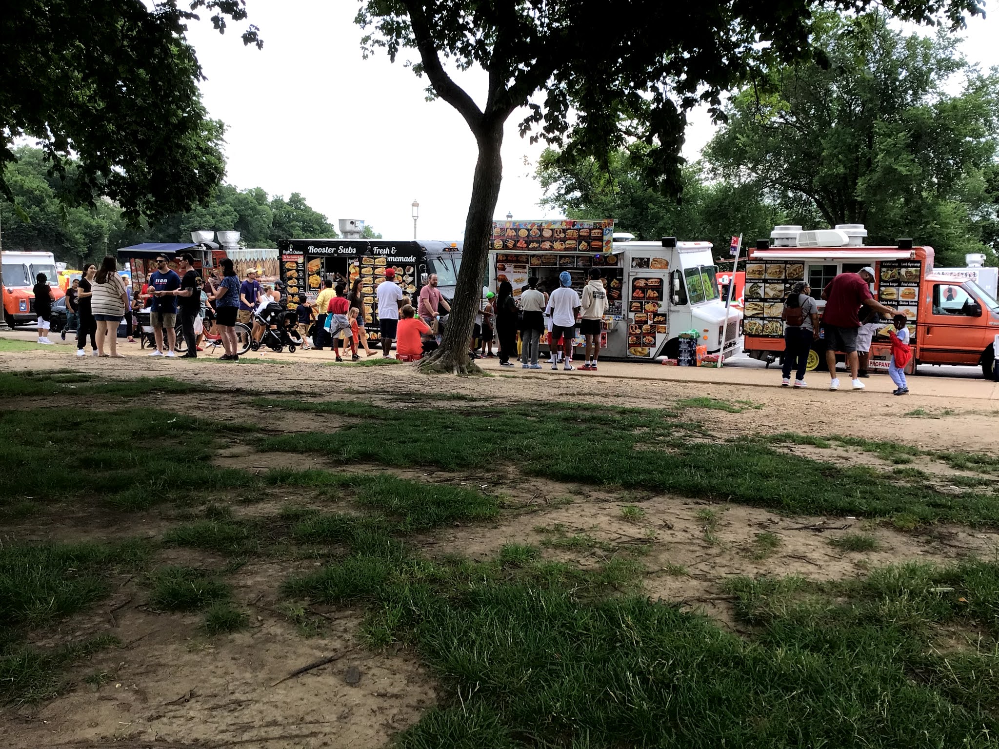
One thing that caught my interest was the large number of food trucks that park in front of the Washington Monument. Food truck choices run the gamat from basic American fare (burgers, dogs and fries), Mexican, Greek, Middle Eastern, Chicken and finally, ICE CREAM! The ice cream trucks are particularly obnoxious because they play this one tune over and over and over and over and over and over and, get the point? I can still hear that tune playing in my head.


Food trucks by the score.


The Jefferson Memorial


The World War Two Memorial. There is a stone slab for each of the 50 states.


The World War Two Memorial


The Lincoln Memorial and the Reflection Pool

OK, I've been saving the best for last: our mile long trek to the Lincoln Memorial. It looked like a long way from our position next to the Washington Memorial and the temperature was very warm. Lelia was game to give it a try and she made it fairly easily.


We starting chatting with one of the park rangers at the giant statue of Abe Lincoln and he told us all about the history of the statue and what the symbolism of various elements represented. This serves as a reminder that when you are visiting any of the US National Park, talk to the park rangers and they will give you a lot of good information and history about the park that you are visiting.


Next stop - Mount Vernon!


Having seen most of the sights along the National Mall, we decided to drive to Mount Vernon, George Washington's house on the Potomac River. The GPS Gremlins were on the prowl again and they did their best to get me lost in some residential housing area nearby. After much gnashing of teeth and a few choice words, I was able to disable Siri and let my car GPS take us to the site.

The front facade of Mount Vernon


Some of the out buildings at Mount Vernon.


George's view of the Potomac River from his back porch.


Stained Glass Windows in the Mt. Vernon visitors center


Lelia say, "good bye, we will see you tomorrow at Fredericksburg


Sunday, June 27, 2021

Harper's Ferry PTA


The Engine House where John Brown met his end.
Harper's Ferry, West Virginia

Lelia and I left Antietem and took the long road off the beaten track to Harper's Ferry, West Virginia. The whole town is a "national park" and there is some ground on Bolivar Heights where Stonewall Jackson's Confederate Corps defeated the 11,000 strong Union garrison of Harper's Ferry.

Harper's Ferry is situated at the confluence of the Potomac River and the Shenandoah River and the town is surrounded by high hills on all sides. The town is famous for several things: (1) John Brown's Kerfuffle began and ended here, and (2) there was a Federal armory that made firearms for the US Army. At the start of the Civil War, Union troops burned down the armory so that it would not fall into Confederate hands. The North figured that it couldn't hold Harper's Ferry against any Confederate attack. And they were right.

In September 1862, during Lee's invasion of the north, leading to the battle of Antietam, Stonewall Jackson's corp was tasked with capturing the garrison so that there would not be 11,000 Federal troops in the rear of the Confederate invasion of Maryland. Jackson's corps surrounded the town from the heights and that was pretty much the end of the ball game for the Union garrison. Jackson left AP Hill's division at Harper's Ferry while he marched with the rest of his corps to Sharpsburg to join up with the rest of Lee's army.

After the Civil War, the fortunes of the town were in steep decline as the Federal armory was not rebuilt and the age of the locomotive steam engine diminished the importance of commercial river traffic, thereby rendering the town obsolete.

I hadn't been here for at least ten years, likely longer, and the visitors' center had been moved quite a ways out of town over the intervening years. This means that you have to park your car at the visitors center and then take a shuttle bus into the town. The town seemed very crowded for a thursday afternoon. 

Other than the main street, which is on level ground, most of the town is situated on the hillside and the pitch of the streets is very steep. The stores are what I call the tourist trap variety, selling T-shirts and candy at exhorbitant prices. The terrain was tough going for Lelia (she has a physical disability) and the temperature was around 90-degrees Fahrenheit, so it was hard work going up and down the streets. Bring several bottles of water if you visit in the summer.


Here are a few of the pictures of the town that I took.


The Provist Marshal's headquarters. I liked all of the artificts
and the "moment in time" nature of the display.


The Harper's Ferry Ghost, in the mirror, decided to photo bomb my picture of Lelia.


The Engine House is very tiny. It is hard to imagine 18 men, of whom 16 died, holding out inside this building.
I would like to make a model of this building one day.


The inside of the two bays on the middle and right of the previous picture
of the exterior of the building. It's a tight squeeze inside and I tried to imagine 
18 men holed up in here and fighting. Only two survived the attack by the US Army.


The Potomac and Shenandoah rivers converge at Harper's Ferry.


One of the old bridges, probably destroyed during the Civil War.

Here are some pictures of some of the buildings on the main street in town. This is the only level street in Harper's Ferry. Every other street runs up hill at a steep pitch.


Harper's Ferry is an interesting town with an interesting history, but it is not a place that merits spending a lot of time visiting. Nevertheless, if you are visiting Antietam then you might as well spend part of the day visiting nearby Harper's Ferry. And don't forget to bring your sunscreen and water bottle. You will need both.

NEXT: Washington D.C.