Monday, June 28, 2021

Shuffling Off to Washington DC


Click on all pictures to enlarge


Lelia and I took a break from traipsing ACW battlefields and visited our nation's capital, Washington DC. We also made a side trip to Mount Vernon to visit George Washington's home. More on that later. This was Lelia's first visit to Washington DC and so I got to enjoy seeing the city through her eyes. I hadn't been to the city in quite some time and so I had forgotten how spectacular The Mall looked.

It was a Saturday morning so the inbound traffic wasn't very bad. We were approaching the city from the Virginia side and there comes a moment when the road descends a hill and suddenly the whole city of Washington DC lies there in front of you. Lelia's look of astonishment at her first viewing of the city reminded me a bit of Dorothy seeing the Emerald City of Oz for the first time. Fortunately there were no flying monkeys involved in our travels.

First things first, we found a parking space along The National Mall about half way between the Capital Building and the Washington Monument. The impossible (parking) became possible. The Mall is designed so that the Capital Building, Washington Monument and Lincoln Monument are all in the same line of sight. The Washington Monument is in the middle of the Mall and the Capital and Lincoln Memorial are at opposite ends of the Mall. Thus, if you are in the middle standing at the Washington Monument you can turn and see the Capital Building on one side and then turn the other way and see the Lincoln Memorial.

I am posting pictures of the three buildings as they would line up:


Lelia in front of the Capital Building


The Washington Monument. 

The Lincoln Memorial


I'm serving my country by holding up the Washington Monument
and keeping it from toppling over.


One thing that caught my interest was the large number of food trucks that park in front of the Washington Monument. Food truck choices run the gamat from basic American fare (burgers, dogs and fries), Mexican, Greek, Middle Eastern, Chicken and finally, ICE CREAM! The ice cream trucks are particularly obnoxious because they play this one tune over and over and over and over and over and over and, get the point? I can still hear that tune playing in my head.


Food trucks by the score.


The Jefferson Memorial


The World War Two Memorial. There is a stone slab for each of the 50 states.


The World War Two Memorial


The Lincoln Memorial and the Reflection Pool

OK, I've been saving the best for last: our mile long trek to the Lincoln Memorial. It looked like a long way from our position next to the Washington Memorial and the temperature was very warm. Lelia was game to give it a try and she made it fairly easily.


We starting chatting with one of the park rangers at the giant statue of Abe Lincoln and he told us all about the history of the statue and what the symbolism of various elements represented. This serves as a reminder that when you are visiting any of the US National Park, talk to the park rangers and they will give you a lot of good information and history about the park that you are visiting.


Next stop - Mount Vernon!


Having seen most of the sights along the National Mall, we decided to drive to Mount Vernon, George Washington's house on the Potomac River. The GPS Gremlins were on the prowl again and they did their best to get me lost in some residential housing area nearby. After much gnashing of teeth and a few choice words, I was able to disable Siri and let my car GPS take us to the site.

The front facade of Mount Vernon


Some of the out buildings at Mount Vernon.


George's view of the Potomac River from his back porch.


Stained Glass Windows in the Mt. Vernon visitors center


Lelia say, "good bye, we will see you tomorrow at Fredericksburg


Sunday, June 27, 2021

Harper's Ferry PTA


The Engine House where John Brown met his end.
Harper's Ferry, West Virginia

Lelia and I left Antietem and took the long road off the beaten track to Harper's Ferry, West Virginia. The whole town is a "national park" and there is some ground on Bolivar Heights where Stonewall Jackson's Confederate Corps defeated the 11,000 strong Union garrison of Harper's Ferry.

Harper's Ferry is situated at the confluence of the Potomac River and the Shenandoah River and the town is surrounded by high hills on all sides. The town is famous for several things: (1) John Brown's Kerfuffle began and ended here, and (2) there was a Federal armory that made firearms for the US Army. At the start of the Civil War, Union troops burned down the armory so that it would not fall into Confederate hands. The North figured that it couldn't hold Harper's Ferry against any Confederate attack. And they were right.

In September 1862, during Lee's invasion of the north, leading to the battle of Antietam, Stonewall Jackson's corp was tasked with capturing the garrison so that there would not be 11,000 Federal troops in the rear of the Confederate invasion of Maryland. Jackson's corps surrounded the town from the heights and that was pretty much the end of the ball game for the Union garrison. Jackson left AP Hill's division at Harper's Ferry while he marched with the rest of his corps to Sharpsburg to join up with the rest of Lee's army.

After the Civil War, the fortunes of the town were in steep decline as the Federal armory was not rebuilt and the age of the locomotive steam engine diminished the importance of commercial river traffic, thereby rendering the town obsolete.

I hadn't been here for at least ten years, likely longer, and the visitors' center had been moved quite a ways out of town over the intervening years. This means that you have to park your car at the visitors center and then take a shuttle bus into the town. The town seemed very crowded for a thursday afternoon. 

Other than the main street, which is on level ground, most of the town is situated on the hillside and the pitch of the streets is very steep. The stores are what I call the tourist trap variety, selling T-shirts and candy at exhorbitant prices. The terrain was tough going for Lelia (she has a physical disability) and the temperature was around 90-degrees Fahrenheit, so it was hard work going up and down the streets. Bring several bottles of water if you visit in the summer.


Here are a few of the pictures of the town that I took.


The Provist Marshal's headquarters. I liked all of the artificts
and the "moment in time" nature of the display.


The Harper's Ferry Ghost, in the mirror, decided to photo bomb my picture of Lelia.


The Engine House is very tiny. It is hard to imagine 18 men, of whom 16 died, holding out inside this building.
I would like to make a model of this building one day.


The inside of the two bays on the middle and right of the previous picture
of the exterior of the building. It's a tight squeeze inside and I tried to imagine 
18 men holed up in here and fighting. Only two survived the attack by the US Army.


The Potomac and Shenandoah rivers converge at Harper's Ferry.


One of the old bridges, probably destroyed during the Civil War.

Here are some pictures of some of the buildings on the main street in town. This is the only level street in Harper's Ferry. Every other street runs up hill at a steep pitch.


Harper's Ferry is an interesting town with an interesting history, but it is not a place that merits spending a lot of time visiting. Nevertheless, if you are visiting Antietam then you might as well spend part of the day visiting nearby Harper's Ferry. And don't forget to bring your sunscreen and water bottle. You will need both.

NEXT: Washington D.C.


Saturday, June 26, 2021

Looking For Some Cee-gars At Antietem


Burnside's Bridge at Antietem Creek


We left Gettysburg after a two night stay and moved southward towards Sharpsburg, MD to visit the battlefield of Antietam. I am not going to present a potted history of the battle; that can be read Here . Antietem is probably the most complete and protected Civil War battlefield in the USA and because it is a bit off of the beaten track, is never crowded with visitors as compared to Gettysburg. The visitors' center is under construction so the only part open is the well-stocked book shop. I managed to find a treasure or two or five during the shopping phase of our visit.

Antietem National Military Park in Sharpsburg, Maryland.

We spent the night at a fine local Bed and Breakfast place called The Inn At Antietem


Lelia enjoying breakfast at the Inn At Antietam.

The breakfast was awesome (an over used word, but apropos in this case); consisting of Eggs Benedict with asparagus and sausage for the main course, grapefruit with maple syrup/brown sugar carmelized on the surface, and exquisite baked goods such as blueberry scones and mini-pecan squares.


We were well nourished for our tour of the battlefield in the hot sun. Remember to bring a bottle of water when you visit Antietam or any other battlefield. It seems like it has always been around 90-degrees Fahrenheit every time I visit this place.

We started our battlefield visit at the small visitor's center in the park. The facility is undergoing extensive renovation and enlargement so there is no overview film to watch for the first time visitor. A park ranger does give a 30 minute presentation outside the visitors' center and this proved to be very helpful. The visitors center is located on the high ground in what was the center of the Confederate battle line, so there is a very good view of all of the important features in the park. Across from the visitors center is the famous Dunker Church, seen below in the Gardner photograph and in situ present day.


Antietam Visitors Center display.


The Dunker Church at Antietem


After poking our noses into the Dunker Church (not much to see other than some church pews), we got into our car and drove to the north end of the battlefield where General Joe Hooker commenced the battle early in the morning with his I Corps attack through the Miller Cornfield.

The starting point of General Joe Hooker's First Corps attack from the North Woods into the Miller Cornfield


The Miller Wheatfield?
This plot of land is next to the famous cornfield. The East Woods can be seen in the center distance.


Our self drive tour of Antietem started in the northern section where Hooker's I Corps attacked. We made a stop at the famous Miller Corn Field, not much in the way of grown corn this time of year. We moved on to the East Woods and the Mumma Farm where Mansfield'd XII Corps assembled to attack the Confederate center.


Battlefield interpretive marker. American battlefields are well marked in this regard.


The Sunken Road in the Confederate center.

Confederate center looking towards the Sunken Road (located near the tower on the right).


The Sunken Road

The Sunken Road position. Note how the rise in the ground on the other side of the
fences rises and could hide the advance of Union soldiers marching towards this position.

You cannot see the "sink'" in the Sunken Road in this picture. The hollow lies between the two rows of snake rail fencing and runs all the way to the observation tower in the distance. Unfortunately the tower was closed.


This portion of the tour covered everything but the area where Burnside's IX Corps attacked the Confederate left flank at the bridge that now bears his name: Burnside's Bridge. We visited the bridge the next day and then moved on to visit Harper's Ferry, West Virginia.


NEXT UP: Harper's Ferry and Washington DC


Thursday, June 24, 2021

We Found The High Ground At Gettysburg


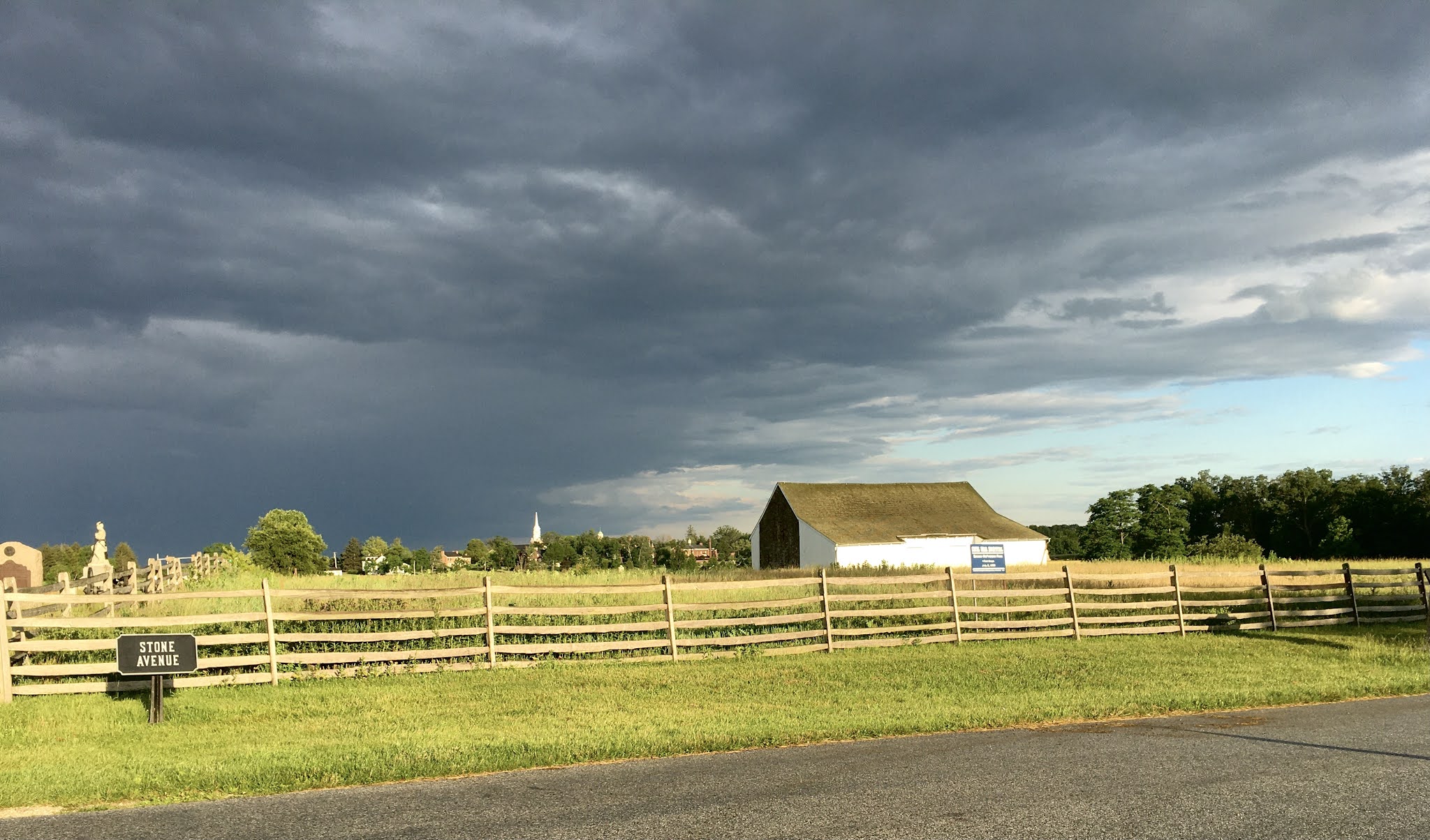
McPherson's Barn atop the ridge of the same name.
This was the first thing we saw as we drove into Gettysburg.


GPS and Siri difficulties not withstanding, we rolled into Gettysburg on a tuesday evening and checked into our hotel, The Inn At Cemetery Hill. The accommodations were a bit better than expected and the hotel was within a block of the intersection of Steinwehr Avenue and Baltimore Pike. In other words, smack dab in the middle of things.

Our initial approach march into Gettysburg came from the west, along the Chambersburg Pike, following the path of the unfortunate Confederate General Henry (Harry) Heth. Lelia was absolutely gobsmacked when we drove over the ridge and there in front of us lay McPherson's Ridge and Barn and the full view of the ground where the first day's battle was fought.


View of Gettysburg looking from west of town on the Chambersburg Pike.

After we unpacked our bags from the baggage train, we did a little exploring of the town and it quickly became apparent to me that there was a noticeable lack of places to have breakfast on the next morn. There appears to be a business opportunity here for some enterprising individual. Fortunately, Lelia had spied the Lincoln Diner on our way through town and after taking another look at the place, it looked to be a suitable site for some morning grub.

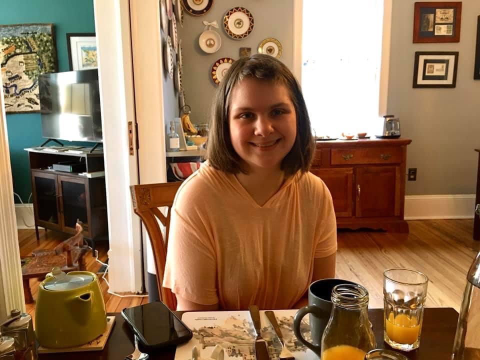
The next morning we arrived at the Lincoln Diner and both had a breakfast of fried hardtack with pork fat. Ok, we really had French Toast and Bacon and some Diet Pepsi for our morning serving of caffeine. I highly recommend coming here for breakfast if you happen to be staying in Gettysburg.


The Lincoln Diner


Dad and Lelia at the Lincoln Diner


After breakfast, we headed over to the Gettysburg Vistors' Center, figuring that it would be a good start for Lelia so that she could get a summary overview of the battle and to view some of the artifacts in the museum. We watched a short film and were ushered upstairs for a viewing of the famous Gettysburg Cyclorama. I was trying to find the Visitors Center in its old location on Cemetery Hill, but then later realized that it had been razed and moved to a new site in 2008. My last visit had been in 2007. The building is nicely rendered in an octagonal shaped structure that calls to mind some of the octagonal barns that one sees in this part of Pennsylvania.


The new (for me at least) Gettysburg Visitors' Center


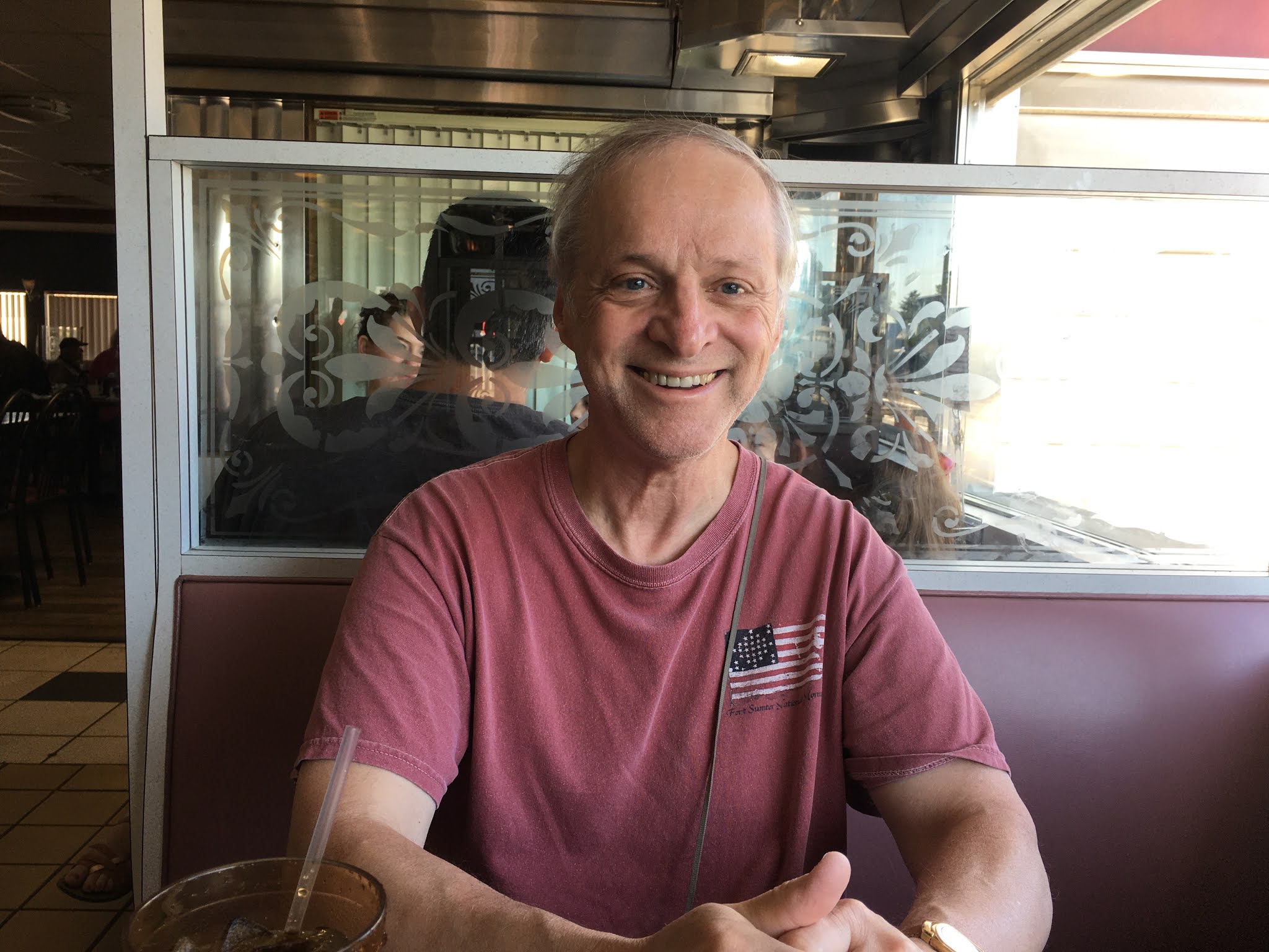
We met this gentleman sitting outside the Visitors Center


One of the panels of the Cyclorama painting. The 3D effect of the mural is amazing.


Here are a few of the thousands of artificts on display at the museum .

Assorted artillery munitions used during the Civil War.
The size of the grape shot in the canister cone amazed me.

Believe it or not, most of the musical instruments in the display are saxophones of various types.

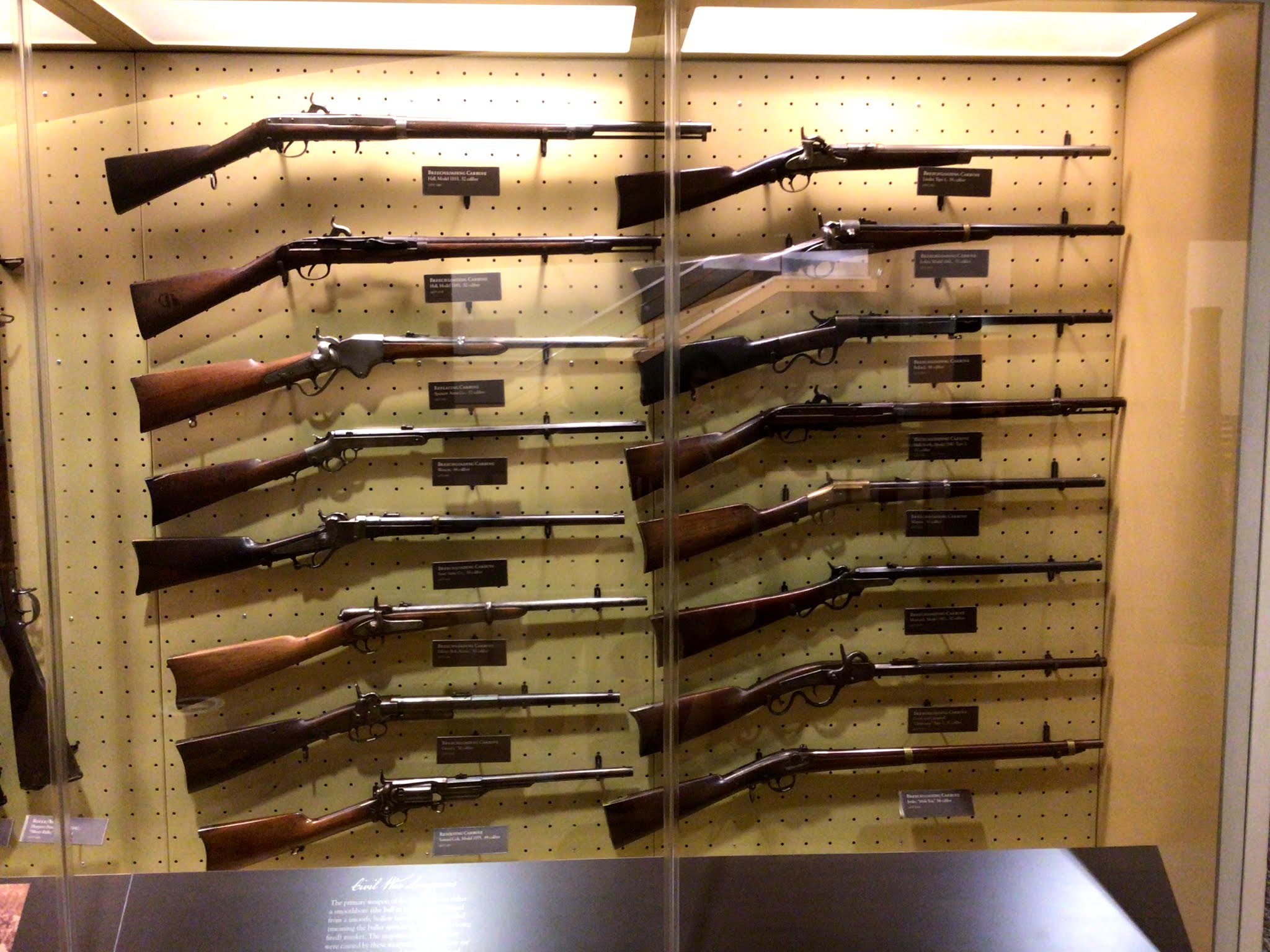
Various Civil War era carbines typically used by cavalry.
I later purchased an 1860 model Spencer Carbine for my collection.

After viewing the museum and the Cyclorama painting, we drove over to Cemetery Ridge to look at the monuments and kill some time whilst waiting for a park ranger tour of Little Round Top at 2PM.


Lelia met a couple of Parrots on Cemetery Ridge

I taught Lelia how to spot the difference between a 10-pound Parrot, a 12-pound Napoleon, a 12-pound Howitzer and a 3-inch Ordnance Rifle.

Lelia climbed to the top of the Pennsylvania monument (against my better judgement)
to get a better view of the battlefield.


There was no holding back of Lelia when we reached the massive Pennsylvania monument on Cemetery Ridge. She was determined to climb the steep spiral staircase inside that leads to the rooftop terrace of the monument. Given her Cerebral Palsy, I wasn't sure that she could make the climb, but she soldiered on and made it to the top with relative ease. I was more worried about the stairs than she was - well, actually, she wasn't worried at all about the staircase.

The climb to the top rewards your effort with some magnificent views of the entire battlefield. The pictures below start with the view north towards Ziegler's Grove and panning south towards the two Round Tops.


Cemetery Ridge as seen from the top of the Pennsylvania monument.


The view of the Codori Farm in the middle distance.
This is part of the ground  crossed by Picket's Charge on the third day of Gettysburg.


Looking towards the Peach Orchard (upper right corner).


Views of Little Round Top (left) and Round Top (right)


It was getting close to 2PM so we descended the spiral staircase and hopped into our car for the short drive to Little Round Top. A park ranger was scheduled to give a talk and one hour tour, starting at 2pm. If you are ever at Gettysburg, take advantage of the free park ranger tours. You can also hire a licensed battlefield guide for a fee and spend several hours up to all day on this type of tour.

Gettysburg Park Ranger leads a one hour tour of the fighting at Little Round Top.


The left flank of the Union line on Little Round Top. This is where the 20th Maine earned some glory.


A view of Little Round Top from the Valley of Death along Plum Run.
Click on the picture to enlarge. The little white specks near the monument on the left are people. 
This illustrates how hard it would have been to make targets out.


Devil's Den, just below Little Round Top. The site was covered with trees and brush at my last visit in 2007. The area has since been cleared of underbrush and trees that were not there in 1863.


One of the little factoids that I learned from the Park Ranger was that the fight of the 20th Maine did not play out like Hollywood depicted it in the movie "Gettysburg". Of course I knew that; I just didn't know how. We are all led to believe that the 20th Maine was in a death match with the Alabama brigade to see who could control the hill and win the battle. What really happened was that the 15th Alabama was exhausted and fairly well knackered by the time it made its last ascent of Little Round Top. Unlike the movie, there were actually something on the order of 3,000 Union soldiers atop Little Round Top fending off the 300 or so Alabamians and the outcome was really never in doubt. Furthermore, Jeff Daniels (I mean Colonel Chamberlain) did not lead a dashing charge down the hill to demolish the hoards of Confederates teeming at the bottom of the hill. The 15th Alabama was out of water, nearly out of ammunition and already at the break point when they heard the clatter of bayonets being affixed to the muskets of the 20th Maine regiment. They knew what that sound meant. That was enough for them (the Alabamians that is) and they skedaddled before the 20th Maine even started moving down the hill.

It was an interesting tour and I enjoyed watching Lelia's reactions as we explored the various parts of Gettysburg battlefield. We were getting very thirsty and sun burned by late afternoon, so we went back to the hotel to chill for awhile (literally chill in the air conditioning). We had dinner that evening at the Dobbins House, which was directly across the street.

After dinner, it was still light enough to drive around the park and see more sights. We ended up driving down the Emmitsburg Road and pulling the car off the road in a turn off that was opposite the Copse of Trees that were the focal point of Pickett's Charge. We made the walk from the road all the way up to the small rock wall and had a little bit of difficulty negotiating our way over the wall.

The Emmitsburg Road around 8PM.

A path leading up from the Emmitsburg Road to the Union lines atop Cemetery Ridge.


The view from the Confederates' point of view.

The site of Cushing's Union battery at the Angle.


The Emmitsburg Road looking south.


The same view rendered in black and white.

We had conquered Cemetery Ridge by about 8:30PM and decided to call it a day. A couple of gentlemen helped Lelia climb over the stone wall (thank you fellows!) and we returned to the hotel. We made one more little stop, at an ice cream store, for a well deserved treat at the end of the day.